Abbott's Creek
The Abbott's Creek watershed starts as just a trickle north of Kernersville, North Carolina. As it makes it's way past High Point, Thomasville and Lexington, various streams and other creeks like Rich Fork, Leonard Creek and many more join the flow. By the time it reaches High Rock Lake it carries a sizable volume of water.

Heading upstream Highway 47 Bridge
Travel on Abbott's Creek is best done with a kayak or canoe but many people venture upstream in boats and personal watercraft. In the video below, ride along as we follow Abbott's Creek all the way from Highway 8 to well past Highway 47 and almost to Interstate 85.


Paddling Abbott's Creek


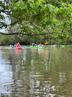
Thanks to a new access on Highway 47, Abbott's Creek has become quite the destination for paddlers. From the access point you can paddle upstream past and through a grove of beautiful cypress trees or you can head downstream into High Rock Lake. In the videos below you can get a birds eye view of the area scenery.
2023 Spring Paddle/Cleanup
In the spring of 2023 a group of paddlers put in at Finch Park in Lexington and paddled down Abbott's Creek to the Highway 47 access. The journey is about five and a half miles and takes around two and a half hours under normal flow. On this particular trip the paddlers picked up trash from the creek along the way.


